On November 1st, coincidentally the 5 year anniversary of setting off on the Bibbulmun Track FKT, I headed out on a solo multi-day fast hike of the new Pilgrim Trail.

Also coincidentally, we got our first sudden heat wave. Temperatures in the hills and wheat belt I was headed to were forecast to be 33C, going up to 39C by the fifth and final day. But I had carved out five whole days for this trip. Putting it off wasn't a luxury I had - not with summer coming and the creeks drying up by the hour, either.
Before launching into my adventure, I should back up to describe this trail and its inception.
It must have been at least a year ago that I saw the first Pilgrim Trail marker whilst trail running in Walyunga National Park. I'd heard rumblings about it and had kept my eye on it. But there were issues that I wanted to wait out.
The "trail" was first walked as a group pilgrimage in 2009. It was meant to be a one-off, according to the Pilgrim Trail website. The founder, Duncan Jefferson, had travelled to the Camino de Santiago (Way of St James trail) in Europe the year before, which sowed the seed for the idea. I understand that after that "one-off" 8-day group hike, Duncan set the wheels in motion to make it a dedicated and signed trail for all. What took place over the next six years I can imagine - a whole lot of continued dedication and passion on his part and that of the group who joined him to help make this a truly public trail.
The route: The photo below shows how the route looked at November 1 2016, according to the gpx track provided by The Pilgrim Trail. Please note, though, that I'm hoping to work with the team of volunteers to help them fix up the numerous small but critical errors on their gpx files, maps, and website. There are at least two errors in this gpx image you see below...but for a general overview, you get the idea of the route!
How long is it? Well, there was some conflict between information on their website and maps and gpx files. It appeared to be anywhere from 160 - 202km. Well, I can tell you now that it's about 185km. And a total of 2,000m climbing. I've noticed they've corrected the website with the distance information, hooray!
The "trail" originally travelled for about 50km up the very busy and noisy Great Northern Highway. They set out to find alternate routes for future years and the trail was run through numerous private properties. That was also not workable, as hikers had to request permissions from land owners in advance of their walks. Until now, all pilgrimages have been done as group outings, typically in September and October each year. Many take place under the original "Camino Salvado" banner, though there are a few school groups I've heard of doing it, too (whether they're Christian schools, I'm not sure). Every night on the 8 day journey, a bus picks up the group and transports them to some kind of accommodation in the area.
Why two names? That confused me at first. Well, The Pilgrim Trail Foundation was created as a separate organisation to manage the trail independently of the St Joseph's Church community that used the "Camino Salvado" banner. The trail was set to become a means for anyone, irrespective of religious belief, to engage in a reflective journey of self-exploration through the simple act of movement from one place to another on foot. For many of us modern city-dwellers, it's a special opportunity to travel from city to bush on one's own two feet and perhaps consider the Aboriginal heritage of this land and their history of walking long distances, as well.
As far as any of us know, I'm the first one to set off on a solo pilgrimage of the trail. I spent a few days of my time in advance reviewing the route and assessing available water sources and accommodation, including wild camping, so that I could be self-sufficient (without crew support in a vehicle). I drove much of the route beyond Walyunga National Park over the course of a half day.

Navigation: The website warns that the "city section is NOT signed so please remember to take your street maps/mobile phone with you." Indeed, I saw two markers over the entire day. Those were actually stickers that had been placed at the bridge into Guildford and were within 100m of each other about 22km from the start. There were four conflicts between the maps and gpx file. I was aware of one of those before I started. The other three I got to experience and deal with in the moment.
The Story: I set off about 11am on the first day. There was no rush to start early, as I was going to have to make camp in 26km at the Discovery Parks caravan park in Caversham. This caravan park is located just 900 metres west of the "trail." I put trail in quotes there just because at that point it seems a little odd to call it a trail when you're walking on paved footpaths along the busy West Swan Road.
I started at St Joseph's Church in Subiaco, on Salvado Road (named after Dom Salvado who started the New Norcia monastery). I thought this was THE place to start. And also assumed there was ONE trail out of town towards the Swan Valley wine region. Within 15 minutes, I was cursing the lack of consistency between the map and gpx file on my wrist. It wasn't until later that night I re-read the additional website info for Day 1 and saw their suggestion that there are "several places of interest to begin the Pilgrim Trail from," including a former Benedictine Monastery in Wembley, St Joseph's Church, Subiaco (the original trail head of the Camino Salvado), or Kings Park. All routes should aim for St George's Terrace in the CBD and pass St Mary's Cathedral. I stayed on the footpath/bike path along the railway line and into the CBD that way, skipping Kings Park. Though that park is nice, that route would had have me alongside roads with a lot more traffic and road crossings. The bike paths are nice and quiet. I'd recommend this route to everyone, unless they really want to go past a certain other church.
I stopped in to an older, grand looking church I passed in the CBD, assuming it might be part of the route, but realised it was an Anglican church, not Catholic! No worries, the trail has gone non-sectarian, so I wasn't going to get in trouble for being more inclusive in my pilgrim explorations ;-) I later passed St Mary's Cathedral, which was definitely Catholic, and a noon service was taking place. I was surprised to see over 200 people gathered on a weekday lunch hour there.
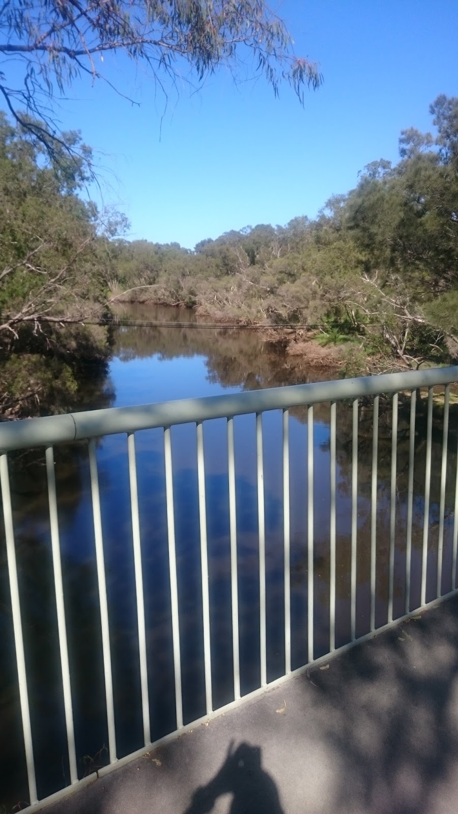
From East Perth, the trail carried on along the bike paths by the Swan River until reaching the very historic looking town of Guildford. My all-afternoon pleasant amble along paths and the river, amongst quiet suburbs, came to an abrupt halt as I popped out onto Bridge Street on the west end of Guildford, right at peak traffic hour.
The last 4km of the day was spent hiking up the busy West Swan Road towards Caversham and my camping spot. It's hard to find something nice to say about walking up a busy highway, especially after spending all day alongside a quiet river. But the good points included seeing the historical buildings and reading the many historical signs along the way through town and north of town, which give a lot more context to the area and the pilgrimage itself (mentioning the Noongar Aboriginals of the area and Bishop Salvado, amongst others). It provided a chance to purchase food or drink, as there was nothing along the way after the CBD. And it made me grateful I had the opportunity to walk and wasn't one of the people stuck in a car :)
The caravan park was well-maintained and equipped with a good camp kitchen. But it was pretty darn expensive for someone just tenting, I thought. And the tent sites are right on the edge of Benara Road - a surprisingly busy road that has traffic going strong most hours of the day. But given the trail starts in the city and travels through suburbs to get to the wilderness bush areas, lands are private and there are no wild camping options. One could find a hotel or B'n'B option around Guildford. Other than the Caversham caravan park, the next camping option was Swan Valley Tourist Park. This is right on West Swan Road, so it's right on the Pilgrim Trail route - no bonus "out-and-back" diversion is required. It appears to be $35 as opposed to the $30 I paid for the tent site at Discovery Parks. It's located right next to a Caltex Petrol Station, but does have big brickwork fencing around the complex, which might help reduce sound.
After that, there's no camping option I'm aware of until Walyunga National Park (~50km). So, the options for camping from the start at St Joseph's are currently, as I see it:
(1) 26km (includes 1 bonus km off the trail on Benara Rd) to Discovery Parks Perth Vineyards, Caversham OR
(2) 29km to Swan Valley Tourist Park OR
(3) 50km (includes 1 bonus km off the Pilgrim Trail) to the designated camping grounds within Walyunga National Park*
*Requires contacting the ranger in advance to obtain the permission to camp. It's a rough camp - I've stayed there before. Just a dunny/outhouse provided. But down near the river/main picnic area, there are picnic tables, a rainwater tank, toilet block, and BBQs running on gas (They won't boil water for your gnocchi - don't try - I did.)
Day 1 Highlights: The unique feel of transitioning from city towards the countryside by walking from central Perth to the quiet outer suburbs alongside the Swan River. Numerous historical signs and buildings interspersed between river sections. This "city" section was surprisingly enjoyable and relaxing, as the route follows bike and walk paths riverside much of the way and goes through several urban parks.
Day 1 Lowlights: Filling up water bottles/bladders from Australian "bubbler" fountains! It'll be nice when these are all replaced with fountains that are at an angle rather than shooting water straight up in the air, making it impossible to collect water. The first ingested fly of the season - inhaled up my right nostril. Leaving the peace of the river for the noise and pollution of peak hour traffic coming in to Guildford.

Navigation: Day 2's distance included the 900 metre bonus start from the caravan park back to the "trail" on West Swan Road, as well as a 1km error section where I was lost, due to conflicts between the maps and gpx file. I encountered 1 Pilgrim Trail marker at 13.5k into my day (though it pointed the wrong way, as it was nailed in poorly) and then several markers once near/in Walyunga National Park in the early afternoon.
Note to Cyclists: Unfortunately for you, this section passes through Walyunga NP, which is off limits to bicycles. Even if you chose to disobey the law on that, you'd probably find in an annoying hike-a-bike in rocky, overgrown single track and steep climbs. The rangers are on-site in the park. I always see them when I'm there and there are live-in caretakers and an active fire lookout. You'll have to travel from Cathedral Ave west to Great Northern Highway and north to Chittering Road to join up with the trail again from Chittering Road.

Also coincidentally, we got our first sudden heat wave. Temperatures in the hills and wheat belt I was headed to were forecast to be 33C, going up to 39C by the fifth and final day. But I had carved out five whole days for this trip. Putting it off wasn't a luxury I had - not with summer coming and the creeks drying up by the hour, either.
Before launching into my adventure, I should back up to describe this trail and its inception.
It must have been at least a year ago that I saw the first Pilgrim Trail marker whilst trail running in Walyunga National Park. I'd heard rumblings about it and had kept my eye on it. But there were issues that I wanted to wait out.
The "trail" was first walked as a group pilgrimage in 2009. It was meant to be a one-off, according to the Pilgrim Trail website. The founder, Duncan Jefferson, had travelled to the Camino de Santiago (Way of St James trail) in Europe the year before, which sowed the seed for the idea. I understand that after that "one-off" 8-day group hike, Duncan set the wheels in motion to make it a dedicated and signed trail for all. What took place over the next six years I can imagine - a whole lot of continued dedication and passion on his part and that of the group who joined him to help make this a truly public trail.
The route: The photo below shows how the route looked at November 1 2016, according to the gpx track provided by The Pilgrim Trail. Please note, though, that I'm hoping to work with the team of volunteers to help them fix up the numerous small but critical errors on their gpx files, maps, and website. There are at least two errors in this gpx image you see below...but for a general overview, you get the idea of the route!
How long is it? Well, there was some conflict between information on their website and maps and gpx files. It appeared to be anywhere from 160 - 202km. Well, I can tell you now that it's about 185km. And a total of 2,000m climbing. I've noticed they've corrected the website with the distance information, hooray!
 |
| The general route from Subiaco to New Norcia - a few gpx corrections to be made |
Why two names? That confused me at first. Well, The Pilgrim Trail Foundation was created as a separate organisation to manage the trail independently of the St Joseph's Church community that used the "Camino Salvado" banner. The trail was set to become a means for anyone, irrespective of religious belief, to engage in a reflective journey of self-exploration through the simple act of movement from one place to another on foot. For many of us modern city-dwellers, it's a special opportunity to travel from city to bush on one's own two feet and perhaps consider the Aboriginal heritage of this land and their history of walking long distances, as well.
As far as any of us know, I'm the first one to set off on a solo pilgrimage of the trail. I spent a few days of my time in advance reviewing the route and assessing available water sources and accommodation, including wild camping, so that I could be self-sufficient (without crew support in a vehicle). I drove much of the route beyond Walyunga National Park over the course of a half day.
Day 1: 26km + 155m - 145m (6.5 hours cruisy pace)
Subiaco to Caversham
Subiaco to Caversham

Navigation: The website warns that the "city section is NOT signed so please remember to take your street maps/mobile phone with you." Indeed, I saw two markers over the entire day. Those were actually stickers that had been placed at the bridge into Guildford and were within 100m of each other about 22km from the start. There were four conflicts between the maps and gpx file. I was aware of one of those before I started. The other three I got to experience and deal with in the moment.
The Story: I set off about 11am on the first day. There was no rush to start early, as I was going to have to make camp in 26km at the Discovery Parks caravan park in Caversham. This caravan park is located just 900 metres west of the "trail." I put trail in quotes there just because at that point it seems a little odd to call it a trail when you're walking on paved footpaths along the busy West Swan Road.
I started at St Joseph's Church in Subiaco, on Salvado Road (named after Dom Salvado who started the New Norcia monastery). I thought this was THE place to start. And also assumed there was ONE trail out of town towards the Swan Valley wine region. Within 15 minutes, I was cursing the lack of consistency between the map and gpx file on my wrist. It wasn't until later that night I re-read the additional website info for Day 1 and saw their suggestion that there are "several places of interest to begin the Pilgrim Trail from," including a former Benedictine Monastery in Wembley, St Joseph's Church, Subiaco (the original trail head of the Camino Salvado), or Kings Park. All routes should aim for St George's Terrace in the CBD and pass St Mary's Cathedral. I stayed on the footpath/bike path along the railway line and into the CBD that way, skipping Kings Park. Though that park is nice, that route would had have me alongside roads with a lot more traffic and road crossings. The bike paths are nice and quiet. I'd recommend this route to everyone, unless they really want to go past a certain other church.
 |
| Wonderful paths alongside Swan River after the CBD. |
I stopped in to an older, grand looking church I passed in the CBD, assuming it might be part of the route, but realised it was an Anglican church, not Catholic! No worries, the trail has gone non-sectarian, so I wasn't going to get in trouble for being more inclusive in my pilgrim explorations ;-) I later passed St Mary's Cathedral, which was definitely Catholic, and a noon service was taking place. I was surprised to see over 200 people gathered on a weekday lunch hour there.
From East Perth, the trail carried on along the bike paths by the Swan River until reaching the very historic looking town of Guildford. My all-afternoon pleasant amble along paths and the river, amongst quiet suburbs, came to an abrupt halt as I popped out onto Bridge Street on the west end of Guildford, right at peak traffic hour.
 |
| Thanks to the town planners for putting in so many great greenways. |
 |
| Welcome to Guildford. Services come with city noises. |
The last 4km of the day was spent hiking up the busy West Swan Road towards Caversham and my camping spot. It's hard to find something nice to say about walking up a busy highway, especially after spending all day alongside a quiet river. But the good points included seeing the historical buildings and reading the many historical signs along the way through town and north of town, which give a lot more context to the area and the pilgrimage itself (mentioning the Noongar Aboriginals of the area and Bishop Salvado, amongst others). It provided a chance to purchase food or drink, as there was nothing along the way after the CBD. And it made me grateful I had the opportunity to walk and wasn't one of the people stuck in a car :)
 |
| A quick photo in Guildford before another car goes by! |
The caravan park was well-maintained and equipped with a good camp kitchen. But it was pretty darn expensive for someone just tenting, I thought. And the tent sites are right on the edge of Benara Road - a surprisingly busy road that has traffic going strong most hours of the day. But given the trail starts in the city and travels through suburbs to get to the wilderness bush areas, lands are private and there are no wild camping options. One could find a hotel or B'n'B option around Guildford. Other than the Caversham caravan park, the next camping option was Swan Valley Tourist Park. This is right on West Swan Road, so it's right on the Pilgrim Trail route - no bonus "out-and-back" diversion is required. It appears to be $35 as opposed to the $30 I paid for the tent site at Discovery Parks. It's located right next to a Caltex Petrol Station, but does have big brickwork fencing around the complex, which might help reduce sound.
After that, there's no camping option I'm aware of until Walyunga National Park (~50km). So, the options for camping from the start at St Joseph's are currently, as I see it:
(1) 26km (includes 1 bonus km off the trail on Benara Rd) to Discovery Parks Perth Vineyards, Caversham OR
(2) 29km to Swan Valley Tourist Park OR
(3) 50km (includes 1 bonus km off the Pilgrim Trail) to the designated camping grounds within Walyunga National Park*
*Requires contacting the ranger in advance to obtain the permission to camp. It's a rough camp - I've stayed there before. Just a dunny/outhouse provided. But down near the river/main picnic area, there are picnic tables, a rainwater tank, toilet block, and BBQs running on gas (They won't boil water for your gnocchi - don't try - I did.)
Day 1 Highlights: The unique feel of transitioning from city towards the countryside by walking from central Perth to the quiet outer suburbs alongside the Swan River. Numerous historical signs and buildings interspersed between river sections. This "city" section was surprisingly enjoyable and relaxing, as the route follows bike and walk paths riverside much of the way and goes through several urban parks.
Day 1 Lowlights: Filling up water bottles/bladders from Australian "bubbler" fountains! It'll be nice when these are all replaced with fountains that are at an angle rather than shooting water straight up in the air, making it impossible to collect water. The first ingested fly of the season - inhaled up my right nostril. Leaving the peace of the river for the noise and pollution of peak hour traffic coming in to Guildford.
Day 2: 35km + 590m - 360m (10 hours steady pace with 1hr lunch/water refill)
Caversham to north end of Walyunga National Park
Caversham to north end of Walyunga National Park

Note to Cyclists: Unfortunately for you, this section passes through Walyunga NP, which is off limits to bicycles. Even if you chose to disobey the law on that, you'd probably find in an annoying hike-a-bike in rocky, overgrown single track and steep climbs. The rangers are on-site in the park. I always see them when I'm there and there are live-in caretakers and an active fire lookout. You'll have to travel from Cathedral Ave west to Great Northern Highway and north to Chittering Road to join up with the trail again from Chittering Road.
The Story: The first 7km follows a footpath alongside West Swan Road. It's a busy road. Though restricted to 70kph from memory, it was still chock-a-block with vehicles, so very noisy and hardly relaxing. The route does pass some places of interest to many hiker-types, such as a chocolate factory, a coffee roastery, and cafes. But they aren't open at Adventure O'Clock for early risers! There was a petrol station I took advantage of just before turning east off that road, as I knew it was my last opportunity for anything purchased for the rest of the trip.
 |
| Crossing the Swan River at Maali Bridge Park |
The transition off West Swan Road onto Douglas Road/Barrett Street, crossing the Swan River, was dramatic. Sudden, beautiful silence. The little zig zag path down to the Swan River bridge and park was like arriving at an oasis. The route carried along the quiet road to cross Great Northern Highway, where it cut through a very small subdivision in Herne Hill. Then it was north towards Bells Rapids Park on the south of Walyunga National Park.
The first Pilgrim Trail marker I saw on Day 2 was at 13.5k, nailed onto a rock. However, it pointed the wrong way because it was only nailed in one of the three holes, so had rotated 90 degrees! I turned it and jammed a tiny rock under the arrow to try to hold it in position.
Headed towards Bells Rapids Park, I neglected to get out my maps for reference and just relied on the gpx file. It had me turn onto a side road. Soon I was through a gate, headed into the "Equestrian WA" complex. The track turned right - straight down a steep, overgrown hillside covered in spiderwebs, towards a marsh/stream/pond below. I was surprised by the route and searched to either side for a proper trail. I got to the bottom and surveyed the area - it was indeed a big bog/marsh. There was no bridge. I went up and down that hill in a few spots, looking for a track, but the GPS would tell me I was off course every time I headed north or south of my position. I finally walked back to the original horse gate I'd gone through to enter the area and simply traversed across the property. I'm guessing a Camino Salvado group had come through and had an arranged lunch stop at the Equestrian Centre ... but how they got there from Holstein Close, I have no idea! I walked through all the maze of horse jumps, glad there was no one out practicing to disturb.
 |
| This is where you need to walk on water. I'm a less evolved pilgrim. |
Once at the main block of buildings, my GPS told me I was back on track. I later saw that the map had indicated I should simply follow Cathedral Avenue all the way to the rapids park. That is, however, not a very nice route, compared to the riverside trail one could take AFTER the equestrian centre. That's the one on the gpx file, so the one I took. So, my impression is that the route needs to stay on Cathedral Ave past Holstein Close, until it reaches the entry to Equestrian WA. Then a person can go down to join the peaceful "Orlov trail" per Google maps to get riverside. I spent a good 10 minutes soaking myself down to cool off - mentally and physically. I was a little flustered and frustrated after battling the steep terrain with the spiders and grasses and old barbed wire fencing in 33C heat.
Bells Rapids was beautiful and there were many people there enjoying it. I crossed the bridge and headed east, then north, following the edge of the river. Pilgrim Trail markers suddenly appeared in earnest - how exciting! Though the first one had been stolen right out of the signpost! I headed into rocky single track. This is something I'd normally love. But a plant I like to say is "reed-like" - I think it's Montbretia (aka Falling Star or Copper Tips) - was falling its copper-tipped stars all over the trail! These things grow really tall with their orange flowers at the top and then lean right over onto the trail. They are huge and quite the trippy hazard. It was just totally annoying. Walking required shuffling steps so that one could push the leaves ahead using the shins, rather than trying to step into or over them.
 The route into Walyunga National Park (NP) had me trying to guess at trails again a bit when the GPS seemed slightly askew and the signage came to an abrupt end after a few km's. But I was distracted from that by the adventure of entering Walyunga NP from a route I'd never travelled before. As I entered the park, I walked through an area signed as being of Aboriginal significance. Again, a minor loss of trail/route had me flustered for 10 minutes or so. But soon enough I was walking into the main carpark in the park, complete with its rainwater tank, toilet block, and BBQs. Given this was the last water I expected to encounter for 24 hours (before Brockman River), I decided to have dinner for lunch and lunch for dinner. This meant I would get out the stove and cook up my gnocchi and pizza sauce sachet. The eating on this trip was not gourmet, but when you're ravenous and all weight counts.... Whilst lunch cooked, I purified rainwater with the Steripen. Too bad the Steripen can't make it look clear instead of like the weak tea it came out of the tank looking! Oh well, that's just a mental thing. Get it in the hydration pack bladder and you can't see its colour anymore! Food eaten, dishes done, I prepared to hike myself up that massive hill known as the Echidna Trail in Walyunga. The Pilgrim Trail follows it for a bit. The heat was full-on. As noted in the Day 1 notes, there is camping in the NP, located about 2km past the carpark on the Pilgrim Trail (starting the climb north on Echidna) plus a 1km detour west off Echidna, climbing a fire trail. This is not signed, so a person would need the info in advance in order to find the camping area.
I wanted to get as much distance as I could out of the day, setting me up better for the following bigger mile days. So I continued straight out the north end of the NP. At that point, the Pilgrim Trail turns east and travels an apparently gazetted public fire trail that connects it to Shady Hills View, a little bitumen road in a little community of acreages east of Bullsbrook. Once out there, it's all acreages, so wild camping would be very challenging. And there are no B'n'B's or motels on the route. So I stopped along that little gazetted fire trail for the night. I had enough daylight left to set up the tent, finish charging electronics via the solar panel, and make some muddy puddle coffee. Seriously. I was going through my rainwater tank water so fast I had stopped along the way to take water from a muddle puddle on a firetrail, pre-filtered it for sediment, and purified it. I enjoyed said coffee whilst watching the sun set and feeding the mossies.
Day 2 Highlights: Finding the little Maali Bridge Park after noisy, smelly roadside walking. Seeing Bells Rapids for the first time and following new trails (for me) into Walyunga NP. My very pleasant camp at day's end.
Day 2 Lowlights: Getting lost in the equestrian area. Then having another two short confused spells on the trails. Given the heat, trying to 'intuit' the trail could get wearisome. Finding two ticks doing walkabout on me at two different times during the day; luckily I got them before they got me.

The Story: I was packed and on the move by 5.40am. No need to set an alarm in WA summertime! The birds will have you awake just before sunrise. I was onto bitumen country roads soon and remained on bitumen for about 2.5 hours. Along the way through this subdivision of acreages east of Bullsbrook, I watched for other potential wild camping options. I think it would be legal to camp beside the Bullsbrook Bridle Trail, and there is the bonus of a low flowing creek there, but it's also right alongside a road. Though not busy, it's also not private. It wouldn't be my pick if I could help it.
The trail connects to Chittering Road and heads east towards Avon Valley National Park (NP). It was quiet and tree-lined, so not bad walking at all. The trail then continues east where Chittering Road curves northbound. The route continues on to cross the Brockman River and transitions to gravel as it ascends alongside Avon Valley NP.
There is an alternate option mentioned here by the Pilgrim Trail crew - to continue following Chittering Road as it curves north. They mention that there are a few services along the road, such as a cafe. But a road is a road is a road. I can't see why one would choose to go up the road rather than through the serenity and dirt tracks of the bushland.
I stopped at the Brockman River crossing for an hour for breakfast (8.30-9.30am), taking advantage of having washing up facilities (i.e., water) for my porridge. I used the time simultaneously to purify nearly 4 litres of water. I wasn't expecting to see water again for a full day (Julimar Brook). I needed to carry 4 litres now, given the heat. It was t-shirt weather from 6am.
From the Brockman River it was a 3km climb up alongside the Avon Valley NP. This section has steep hillside either side of the gravel road and private properties on one side. There would be a couple small spots to set up a tent next to the road, but it wouldn't be very nice if a vehicle went by, spewing up dust and rocks.
From the top, the gravel road seems to act as a border between Leda Nature Reserve and Moondyne Nature Reserve on the left and Avon Valley NP on the right. There were no Pilgrim Trail markers. Navigation was primarily by GPS. The map didn't help much because most of the gravel roads aren't signed. Even recce'ing by car the week before I went off trail in this area.
Wild camping isn't a problem in this section heading northeast, but the bushland is often scrabbly with parrot bush. Camping at a track junction such as this one below is an option. There is NO water anywhere up here after Brockman River. No dried creek beds. Nothing. Maybe in winter you'd get water filling some potholes in the road, that's it. And there are a few signs in the northern section warning of unexploded ammunition. I wouldn't veer too far into the bush for a campsite!
Day 3 Highlights: Solitude throughout the Avon Valley NP and Julimar SF areas. Finding an old Survey Heritage Trail marker this far north of the others I've seen in the bush down near Walyunga NP.
Day 3 Lowlights: Spotting a ditch-weed-spraying council truck on Chittering Road as I was about to take water from the Brockman River adjacent. I knew the rivers were well polluted with pesticides and farm fertilisers as well as with illness-causing bacteria like crypto and giardia. But it was such a harsh reminder. Clean water is so precious. Also a lowlight to find out that Day 5 was going to be longer.
 The route into Walyunga National Park (NP) had me trying to guess at trails again a bit when the GPS seemed slightly askew and the signage came to an abrupt end after a few km's. But I was distracted from that by the adventure of entering Walyunga NP from a route I'd never travelled before. As I entered the park, I walked through an area signed as being of Aboriginal significance. Again, a minor loss of trail/route had me flustered for 10 minutes or so. But soon enough I was walking into the main carpark in the park, complete with its rainwater tank, toilet block, and BBQs. Given this was the last water I expected to encounter for 24 hours (before Brockman River), I decided to have dinner for lunch and lunch for dinner. This meant I would get out the stove and cook up my gnocchi and pizza sauce sachet. The eating on this trip was not gourmet, but when you're ravenous and all weight counts.... Whilst lunch cooked, I purified rainwater with the Steripen. Too bad the Steripen can't make it look clear instead of like the weak tea it came out of the tank looking! Oh well, that's just a mental thing. Get it in the hydration pack bladder and you can't see its colour anymore! Food eaten, dishes done, I prepared to hike myself up that massive hill known as the Echidna Trail in Walyunga. The Pilgrim Trail follows it for a bit. The heat was full-on. As noted in the Day 1 notes, there is camping in the NP, located about 2km past the carpark on the Pilgrim Trail (starting the climb north on Echidna) plus a 1km detour west off Echidna, climbing a fire trail. This is not signed, so a person would need the info in advance in order to find the camping area.
 |
| A fire trail between Bells (after 'reed' section) and before Walyunga NP carpark - a random old walking sign! Quite funny. |
I wanted to get as much distance as I could out of the day, setting me up better for the following bigger mile days. So I continued straight out the north end of the NP. At that point, the Pilgrim Trail turns east and travels an apparently gazetted public fire trail that connects it to Shady Hills View, a little bitumen road in a little community of acreages east of Bullsbrook. Once out there, it's all acreages, so wild camping would be very challenging. And there are no B'n'B's or motels on the route. So I stopped along that little gazetted fire trail for the night. I had enough daylight left to set up the tent, finish charging electronics via the solar panel, and make some muddy puddle coffee. Seriously. I was going through my rainwater tank water so fast I had stopped along the way to take water from a muddle puddle on a firetrail, pre-filtered it for sediment, and purified it. I enjoyed said coffee whilst watching the sun set and feeding the mossies.
 |
| Getting close to the carpark in the NP - more remains of disused trails |
 |
| The silk scarf was brought to be my water pre-filter for water with sediment/floaties. Turned out to have two uses! |
 |
| The very quirky gate (in more ways than one) that one must pass through on leaving the north end of the NP. |
 |
| My sunset view on Day 2. Well earned. And great mobile reception! ;-) |
Day 2 Highlights: Finding the little Maali Bridge Park after noisy, smelly roadside walking. Seeing Bells Rapids for the first time and following new trails (for me) into Walyunga NP. My very pleasant camp at day's end.
Day 2 Lowlights: Getting lost in the equestrian area. Then having another two short confused spells on the trails. Given the heat, trying to 'intuit' the trail could get wearisome. Finding two ticks doing walkabout on me at two different times during the day; luckily I got them before they got me.
Day 3: 54km + 670m - 650m (12 hours hard pace with 1hr breakfast/water refill)
North end of Walyunga National Park to Julimar State Forest

Navigation: Day 3's distance included a 300 metre error where I took a wrong turn (600m out-n-back). The first Pilgrim Trail marker was at 42.5k into my day, in the Julimar State Forest (SF). One must use GPS and maps for navigation solely until there. There were a few short sections such as the Bullsbrook Bridle Trail that cause minor confusion as to which exact trail one should be on. There are two points of signage confusion within the State Forest that apply only if you were walking New Norcia to Perth (signs point the wrong way from that direction). Julimar SF is generally quite well marked - to the point that you get used to seeing signs at junctions, so get worried when you don't see one on a straight section for 2 or 3km. Confidence markers would go a long way. Given the very long day I had, the heat, and the lack of reliable water sources so late in the season, I chose to take the "seasonal" short-cut in the SF, which cut north along the Julimar Brook. This eliminated about 4km of the normal route. In high water, the brook might flow so fast and high that the numerous brook crossings could be a challenge - for me, the challenge was actually being able to spot the dried up brook and the correct trail to follow north!
 |
| Still in my jacket, but only til 6am! |
The trail connects to Chittering Road and heads east towards Avon Valley National Park (NP). It was quiet and tree-lined, so not bad walking at all. The trail then continues east where Chittering Road curves northbound. The route continues on to cross the Brockman River and transitions to gravel as it ascends alongside Avon Valley NP.
 |
| False hopes from several signs on Chittering Road. Empty shelves for me. |
I stopped at the Brockman River crossing for an hour for breakfast (8.30-9.30am), taking advantage of having washing up facilities (i.e., water) for my porridge. I used the time simultaneously to purify nearly 4 litres of water. I wasn't expecting to see water again for a full day (Julimar Brook). I needed to carry 4 litres now, given the heat. It was t-shirt weather from 6am.
 |
| Turning onto the gravel road with Brockman River crossing ahead. Moondyne is off the trail ~4k, but does offer group stay. |
 |
| Muddy, pesticide and herbicide ridden river water. But there's shade! And it's tea time! |
From the Brockman River it was a 3km climb up alongside the Avon Valley NP. This section has steep hillside either side of the gravel road and private properties on one side. There would be a couple small spots to set up a tent next to the road, but it wouldn't be very nice if a vehicle went by, spewing up dust and rocks.
From the top, the gravel road seems to act as a border between Leda Nature Reserve and Moondyne Nature Reserve on the left and Avon Valley NP on the right. There were no Pilgrim Trail markers. Navigation was primarily by GPS. The map didn't help much because most of the gravel roads aren't signed. Even recce'ing by car the week before I went off trail in this area.
Wild camping isn't a problem in this section heading northeast, but the bushland is often scrabbly with parrot bush. Camping at a track junction such as this one below is an option. There is NO water anywhere up here after Brockman River. No dried creek beds. Nothing. Maybe in winter you'd get water filling some potholes in the road, that's it. And there are a few signs in the northern section warning of unexploded ammunition. I wouldn't veer too far into the bush for a campsite!
 |
| Walking along the unsigned Plunket Road, looking to my right at a junction. Honestly, that doesn't look too welcome to me! |
 |
| Another trail junction with an old Survey Heritage Trail marker - what a find! It's a trail that's fallen into disrepair/disuse. |
 |
| Seen at the north end of the Plunket Road traverse of the Avon Valley NP area, looking back where I just came from. |
From the north end of the bush, the route heads north alongside pasture/farm land. There was a creek along Beach Road with some greenish-brown still water. Water that bad is hard to filter, but still good for wetting down a hat!
 |
| Hot, exposed, fly season. That may be a forced smile. |
A 1.5km stint on the bitumenised Julimar Road gets you back into bushland - this time it's the Julimar SF. After 2km, I started to see Pilgrim Trail signs again. Hooray! The signage was set up for people who had been following the Chittering Road option all the way into the SF, which seemed odd, considering their maps and gpx file indicate the main route as I'd followed it. If you were going north to south (towards Perth), you'd end up missing that turn south towards Avon Valley NP and find yourself taking the bitumen route. Don't do that. There was also one other marker I found that was oriented incorrectly for those going north to south. But for me, the markers were correct.
 |
| A tough heat spell in which to do the trail, but beauty everywhere |
I stopped in Julimar SF and had a sit-down on the ground for 15 minutes in the shade to eat a tin of dolmades. It was about 3pm and this was only my second break of the day. I found a tick walking on me, which took the fun out of my rest. So I packed up and moved on. I wanted to get as close to the Julimar Brook as I could for the end of the day. I knew the following day was also going to be a big one, so the more miles I could rack up today, the better. As I neared the brook, the map offered me a "seasonal" route that cut north along the brook, zigzagging from side to side on 4WD tracks. This was to cut off about 4km of the route and seemed prudent, given the heat and water issues. I had some trouble following the exact route, as I just had to go by the map and a north bearing. The 4WD vehicles have had a lot of fun in there in winter, so tracks are quite chewed up and there are many braided tracks.
 |
| The moment in tent discovering Day 5 will be longer. |
Despite the obvious human activity sign in the area, I saw no one in the SF that day and set up a quiet camp at 5.45pm. I had about 45 minutes to do chores before dark. Tent was up first. Then I found a mud puddle not yet dried up and tried it for cleaning up my really dirty legs - it worked. The puddle accepted more dirt offerings. I made a cuppa and tried to enjoy it outside, but the area was full of bull ants and mossies. I retreated to enjoy my coffee in my tent. It was then, reading my maps and the website info, that I realised Day 5 (what they call Day 8) would be longer than the map said - a cruel typo on their part! Mobile reception was gone, being that I was deep in a forest and brook/creek depression, so I was off to sleep quickly.
Day 3 Highlights: Solitude throughout the Avon Valley NP and Julimar SF areas. Finding an old Survey Heritage Trail marker this far north of the others I've seen in the bush down near Walyunga NP.
Day 3 Lowlights: Spotting a ditch-weed-spraying council truck on Chittering Road as I was about to take water from the Brockman River adjacent. I knew the rivers were well polluted with pesticides and farm fertilisers as well as with illness-causing bacteria like crypto and giardia. But it was such a harsh reminder. Clean water is so precious. Also a lowlight to find out that Day 5 was going to be longer.
Day 4: 48km + 520m - 460m (11 hours hard pace with 1hr breakfast/water refill)
Julimar State Forest to Carrah Farm Stay, Calingiri Road


Day 5: 25km + 95m - 180m (4.5 hours steady pace)
Of course it wasn't sexy walking, but by that point, I was ready to enjoy my achievement, so the passing road trains and other vehicles were just unwittingly all part of my internal celebration party :) I decided to make a game of guessing how many vehicles would pass me in this section. I guessed 100, but it was only 52 by the time I got to the town limits sign.

Navigation: Day 4's distance included a 1.5km bonus at the end of the day to get to a farm stay. The day started on Munyerring Spring Road in the SF and there was only 1 Pilgrim Trail marker over that distance. The track then skirted the boundary of the Bindoon military training area and markers were generally present and helpful. As the track started to skirt alongside farm pastures as well, there was one poor shot-up sign, but it was still evident what it was. There could be a few more signs at junctions, but that area was overall pretty well signed. The gpx and maps were referred to throughout this section. Once out on Old Plains Road, there was no signage, not even confidence markers, but at least it was quite obvious from the map where to be from there on.
The Story: 5.20am start. Each day got earlier. I was determined to enjoy as much pre-heat time as I could, but it felt a bit hopeless. I was in a t-shirt from the start. In 45 minutes, I arrived at my precious water source for the day. I had recce'd this part of the Julimar Brook 6 days previous. It was no longer flowing, but just a puddle. I knew of a large pond not much further north and another 800m or so east (off trail), but bonus distance wasn't appealing. Believe it or not, the puddle at my feet was more appealing. Though quite alive with wriggling things that I had to work to remove.
 |
| Another day, another mud puddle breakfast! This was my flowing brook 6 days ago. |
With another 4 litres of water on board, I headed out of the SF towards the military buffer zone. Gauging by the maps, most trail runners wouldn't expect this section to be very interesting. But I found it so. Maybe because I've also got an explorer gene, so I find new areas intriguing. The route followed the edge of the military zone, then zigzagged between farm properties. There were a fair number of Pilgrim Trail markers throughout this area - a few more at junctions would be nice. Again, the day was quiet with not even an illegal 4WD'er passing by.

 |
| Before Old Plains Road - coming out of the military buffer zone area. |
Once out on Old Plains Road, the route was quite straight forward. I had two vehicles pass me over the course of the rest of the day. One, near the end of the day, stopped to check on me and offer me water. What angels! Approaching the junction of Pither Road, I crossed the Salomon Brook near the Gascoyne River. I really enjoyed this day for its transitions between forest, farmland, and what I'll call salt plain.
 |
| The Salomon Brook/Gascoyne River area on Old Plains Road. Sweltering heat, but loving the diversity. |
The heat became so intense on the afternoon of Day 4 I was reduced to walking in blocks. 30 minutes walking, following by 3 to 5 minutes sitting in the shade. I found a few puddles - little creek crossings - a few times and soaked myself down quite thoroughly each time, using my hat to scoop water onto myself. Eating was a challenge, as the heat acted as an appetite suppressant.

 |
| Sign at Rica Erickson Nature Reserve near end of Day 4. |
Wild camping options in this section:
(1) The bushland next to the Bindoon Military Training area, as it also borders Julimar State Forest. Once out on Bulligan Road and Old Plains Road, it's private farmland either side.
(2) Julimar State Forest near Calingiri Road and Old Plains Road junction. The SF is on the left and Rita Erickson Nature Reserve is on the right. This is where I originally planned to make camp. But then I found...
(3) The Carrah Farm Stay. This farm is located on Calingiri Road, 750m east of the Pilgrim Trail. From the entrance to the property, it's another 750m through the property to get to the farmhouse. The owner, Sarah, offers a farmhouse option as well as camping option, both for a fee. Camping cost was very reasonable and she provided access to their rainwater tank, which beat wriggling-creature mud puddle water hands-down! She also allowed me use of the shower. Wow. I nearly cried with gratitude in that shower.
 |
| Carrah Farm Stay - stay on the property MUST be arranged in advance with owners. They need at least 1 week notice. |
Mobile phone reception continued to be sketchy from Julimar SF onwards. I had a few spells of great coverage, particularly closer to Bulligan Road/the military area. North from there it would come and go. At the farm stay, there was one spot I could get patchy service. This was with Telstra, of course. If using a phone as GPS, be sure your map is loaded for use offline, so you save battery power by running in aeroplane mode.
 |
| Uneven tan day. |
Day 4 Highlights: Varied topography, including the "salt plains" of Gascoyne River area. Solitude and quiet (other than flies!). Carrah Farm Stay finish.
Day 4 Lowlights: Heat intensity, requiring shade breaks in the afternoon. The joy of resting in the shade was dampened by the hunting march flies and mosquitoes. Shocked to find mossies active in 33C mid-afternoon heat.
Day 5: 25km + 95m - 180m (4.5 hours steady pace)
Carrah Farm Stay to New Norcia monastery
 |
| Those morning temps Garmin Connect estimates each day are such lies! Bikini weather from 4.15 am! |
Navigation: Day 5's distance included a 1.5km bonus at the start of the day to get from the farm stay back to the trail. There were no Pilgrim Trail markers the entire way, but it was straightforward. Once it town, though, I was unclear where exactly to mark my "finish line."
 |
| 22km up Old Plains Road to the edge of town. |
The Story: I knew it was forecast for 39C in New Norcia and I was determined to get a morning without suffering the entire way. So I was up by 3.45am and on the road at 4.15am. It was bikini weather. The peace of darkness was comforting, but I had my eye on the eastern sky. It was like being hunted. I knew the sun was coming for me. I expected by 6am it might be over the treeline along the road and I'd be exposed without shade breaks. It turned out there were a few more trees along Old Plains Road. No mobile reception until I approached Great Northern Highway, though, so no mental distractions could come that way for me. I covered the distance pretty quickly, since it was mostly a slight downhill all the way to town.
The route started by passing the Moganmoganing Natural Reserve (love the name!), a boggy strip surrounded by rolling hills. Water could be gathered here, but it was getting tricky this time of year - all drying up. The terrain was pretty. Not a car passed. There were a few patches of water along the verge at times and I soaked myself down each time - it was shocking how I was soaking myself down from 5.15am!
I reached Great Northern Highway at the 19km mark (including my 1.5km addition from the farm) and then had 6km into town along the highway verge.
 |
| I was sweating so much they had to put a warning sign on the road. |
 |
| Next year the highway walking will probably be cut to 3km from 6km, given the bypass. |
Of course it wasn't sexy walking, but by that point, I was ready to enjoy my achievement, so the passing road trains and other vehicles were just unwittingly all part of my internal celebration party :) I decided to make a game of guessing how many vehicles would pass me in this section. I guessed 100, but it was only 52 by the time I got to the town limits sign.
 |
| Still at least a km to go, but I'm almost there! |
I hit the petrol station and managed to spot one piece of cold fruit for sale amongst all the fatty pies and sausage rolls. That pear was mine!
Then I aimed for the church where I assumed I'd find with Dom Salvado's crypt. Nothing was marked as such and everything in New Norcia looks holy, so it took some guessing to get myself to the church. Before going inside, I went into the monastery's guest accommodation nearby to ask if there was something special I should do as a Pilgrim Trail pilgrim. I guess I wondered if there might be some sort of little ceremony - a little stamp or certificate or something I'd get. I'd seen photos with a church group beside the crypt of Dom Salvado and read that one could carry a small object to leave there at the end. I'd had some shells on my back the whole way.
 |
| Made it as a solo self-supported pilgrim. |
Well, the reception I got was perfect. In an unexpected way. The woman was very good at crushing self-congratulatory ego's. I think she trained in it. She said bluntly, "What do you need?" I stammered, "Well, I don't really need anything. I just hiked the pilgrim trail from Subiaco and I guess I just wondered if there was anything I should do or anything...." I stumbled over a bunch of words. I felt like a little kid. All I wanted to say was, "Can I have a stamp?" "Do you have a certificate of achievement I can have?" "Will someone wash my feet?"
Her reply was again stern and blunt. "We don't have anything to do with that Pilgrim Trail."
Okay.
She then told me I could see the priest, who was doing confession for a couple family members at that moment. I declined. She seemed surprised. I headed over to the church, to have a quiet moment reflecting on a personal achievement in a personal way.
 |
| The panels depicting the Stations of the Cross in this church are so quirky. A truly Aussie experience. |
 |
| The Head, my new Worry Monk souvenir, and I have a quiet moment in the nice cool church. |


